Overview
Calymnus's solutions span the entire geospatial value chain from consulting, application development, modeling, remote sensing to data migration & conversion. Since inception we have been delivering targeted business solutions using the latest information technologies and geospatial capabilities.
A key Calymnus capability and differentiator is its expertise in process analysis, process design, and process automation. We have our proprietary workflow management and process automation tools that help reduce cost and delivery time, while maintaining the highest levels of quality
Offerings
Consulting
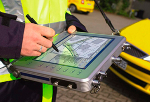
Geospatial Software Applications
Remote Sensing
Image Processing
Consulting
Calymnus strives to provide optimum, business driven solutions and often undertakes a consulting assignment before proposing a comprehensive solution. We assist clients with the assessment of their geographical data needs (User Needs Assessment), data collection and capture procedures, and hardware & software evaluation. We also undertake geospatial workflow analysis and design.
Our consulting assignments help identify data, applications, database design, implementation methods, and training requirements. One of our key consulting strengths lies in identifying ways in which workflows can be optimized or automated to provide immediate productivity gains.
Geospatial Software Applications
Our platform and vendor independent approach allows us to use the best-of-breed technologies to develop solutions grounds up or scale up existing systems. Our service offerings include:
End-to-end, scalable web-based enterprise geospatial applications
Web mapping applications
Customized desktop applications
Workflow Management Systems
Application maintenance ,enhancement and support
Remote Sensing
Calymnus has extensive experience in satellite image interpretation and processing, having worked with most of the commercially available satellite data products.
We use our proprietary methodology to derive valuable and accurate information for a wide range of applications such as mineral mapping, utility planning, natural resource mapping, watershed management, livelihood development, and land use planning, amongst others.
Image Processing
Calymnus is an adept at processing high-resolution imagery into quality raster data products. This involves removing distortions in the images to ensure that outputs are of the highest clarity, resolution, and color. Our service offerings include geo-referencing, ortho-rectification, mosaicing, color balancing, and cutting to specified output formats. We are able to produce a seamless raster data product from multiple image tiles.
We have the ability to handle large volumes of images, automate most of the data management processes, and pass on the productivity gains to the client in terms of fast turn-around- time and competitively priced solutions.